लगभग 1770
The town’s founding is mentioned
The Imperial Gazetteer suggested Barhaj town was founded around 1770; earlier settlements may have existed.
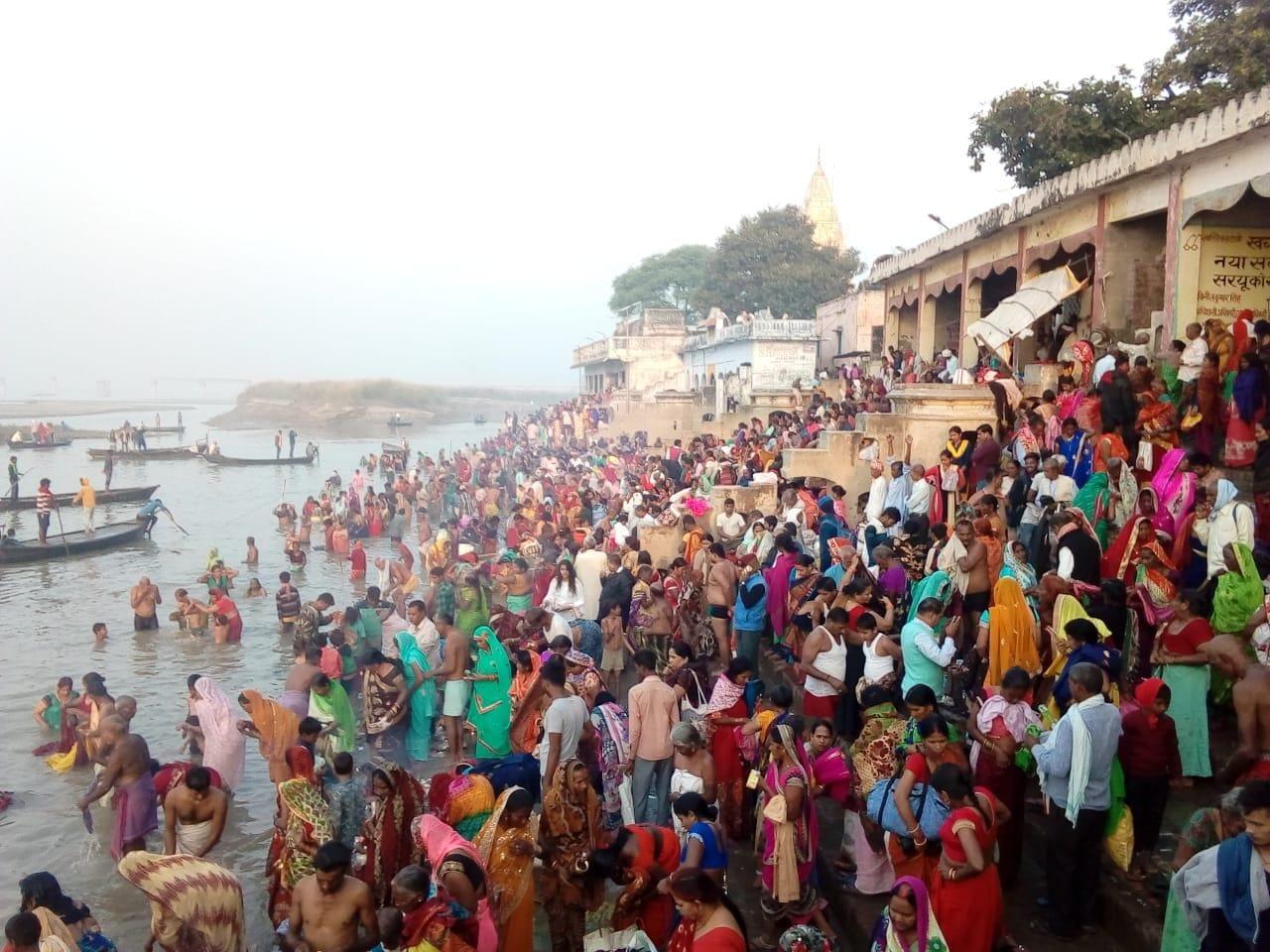
A riverside town of living traditions, fascinating stories and local pride.
From local history to ghats, schools, markets, villages and essential public information — together in one place.
Barhaj, in Deoria district of Uttar Pradesh, is a historic settlement by the Saryu–Ghaghara river. Its past is shaped by sugar trading, water routes, railways, freedom fighters and spiritual traditions.
This guide distinguishes the municipality from the wider tehsil and development block. Historical statistics and local traditions are dated and attributed to their sources.
Read the timeline →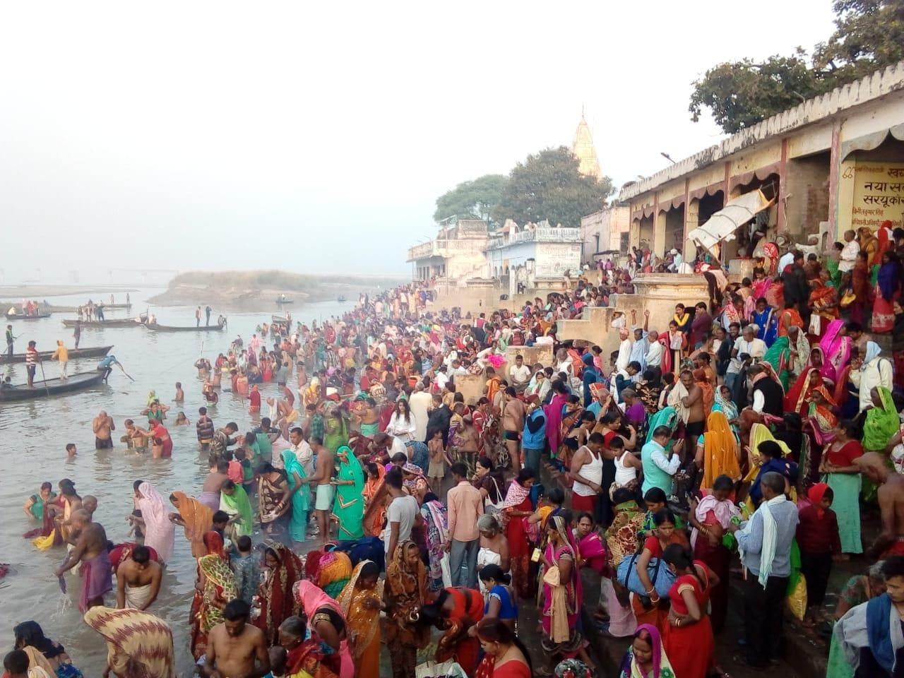
Selected moments from the trading era to modern Barhaj.
The Imperial Gazetteer records a population of 10,054, roughly forty sugar-making works and trade in grain, oilseeds and sugar by river and rail.
The Imperial Gazetteer suggested Barhaj town was founded around 1770; earlier settlements may have existed.
Local accounts date the tradition to 1836; original archival proof remains to be examined.
Paina is remembered for anti-colonial resistance in the region.
Historical railway documentation records the opening of the Salempur–Barhaj Bazar branch.
A population of 10,054 and around forty sugar-making works appear in the Imperial Gazetteer.
Local accounts describe resistance to colonial authority, including an account of seventeen days.
Deoria was created separately from Gorakhpur.
Published Census figures list 36,459 residents in the municipality.
Boundary-extension reporting and a twenty-five-ward electoral structure.
River landscapes, heritage and places of remembrance.
बरहज नगरThe town’s riverside gathering and pilgrimage destination, especially during festive periods.
Find on Google Maps ↗An ashram associated with Baba Raghav Das and the freedom movement.
Find on Google Maps ↗An important local place of worship; please verify visiting details locally.
Find on Google Maps ↗A well-known spiritual landmark in Mayil, listed by the district tourism office.
Find on Google Maps ↗The Rapti and Saryu–Ghaghara river system meets near Kaparwar.
Find on Google Maps ↗Memorial landscape associated with the local resistance of 1857.
Find on Google Maps ↗The historic station that connected the trading town to the rail network.
Find on Google Maps ↗Search documented public listings. Each record includes a source and a map search link.
⌖ बरहज नगर · UDISE 09601600705
⌖ बरहज नगर · UDISE 09601600206
⌖ बरहज नगर · UDISE 09601600202
⌖ बरहज नगर · UDISE 09601600904
⌖ बरहज नगर · UDISE 09601600103
⌖ बरहज नगर · UDISE 09601600303
⌖ बरहज नगर · UDISE 09601600101
⌖ बरहज नगर · UDISE 09601600205
⌖ बरहज नगर · UDISE 09601600204
⌖ बरहज नगर · UDISE 09601600706
⌖ बरहज नगर · UDISE 09601600717
⌖ बरहज नगर · UDISE 09601600710
⌖ बरहज नगर · UDISE 09601600305
⌖ बरहज नगर · UDISE 09601600909
⌖ बरहज नगर · UDISE 09601600720
⌖ बरहज नगर · UDISE 09601600707
⌖ बरहज नगर · UDISE 09601600716
⌖ बरहज नगर · UDISE 09601600302
⌖ बरहज नगर · UDISE 09601600201
⌖ बरहज नगर · UDISE 09601600501
⌖ बरहज नगर · UDISE 09601600905
⌖ बरहज नगर · UDISE 09601600704
⌖ बरहज नगर · UDISE 09601600709
⌖ बरहज नगर · UDISE 09601600602
⌖ बरहज नगर · UDISE 09601600906
⌖ बरहज नगर · UDISE 09601601001
⌖ बरहज नगर · UDISE 09601600703
⌖ बरहज नगर · UDISE 09601600908
⌖ बरहज नगर · UDISE 09601600907
⌖ बरहज नगर · UDISE 09601600801
⌖ बरहज नगर · UDISE 09601600702
⌖ बरहज नगर · UDISE 09601600304
⌖ बरहज नगर · UDISE 09601600718
⌖ बरहज नगर · UDISE 09601600719
⌖ बरहज नगर · UDISE 09601600714
⌖ बरहज नगर · UDISE 09601600715
⌖ पैना
⌖ बरहज
⌖ बरहज
⌖ बरहज
⌖ बरहज
⌖ कपरवार
⌖ बरहज
⌖ बरहज
⌖ गौरा बरहज
⌖ बरहज बाजार
⌖ बरहज
⌖ मइल
⌖ कपरवार
⌖ पैना
⌖ बरहज
⌖ बरहज
Important: These are records from available public directories, not a verified complete list of every school in the tehsil. Confirm current addresses, recognition and operating status with each institution.
The 25 municipal wards and 56 gram panchayats of Barhaj development block.
The panchayat list covers Barhaj development block, not every revenue village in the tehsil. Ward names reflect 2023 electoral reporting.
View actual OpenStreetMap streets, surrounding places and the river. Pan and zoom freely.
The Saryu–Ghaghara and Rapti river system shaped Barhaj’s geography and history.
Sugar, grain, oilseeds and timber formed an important part of its historic trade.
Festivals, Ramleela, Kartik Purnima and Bhojpuri customs bring the community together.
Railway and roadway links connect Barhaj to nearby towns and villages.
The tehsil town serves surrounding rural communities with education and public services.
Riverside communities face monsoon flooding and riverbank erosion.
Apna Barhaj is an independent community heritage and information initiative to document our hometown with care, trustworthy references and local contributions.
Our sources ↗Explore the documents and organisations behind the information.